


Manaslu Circuit Trek
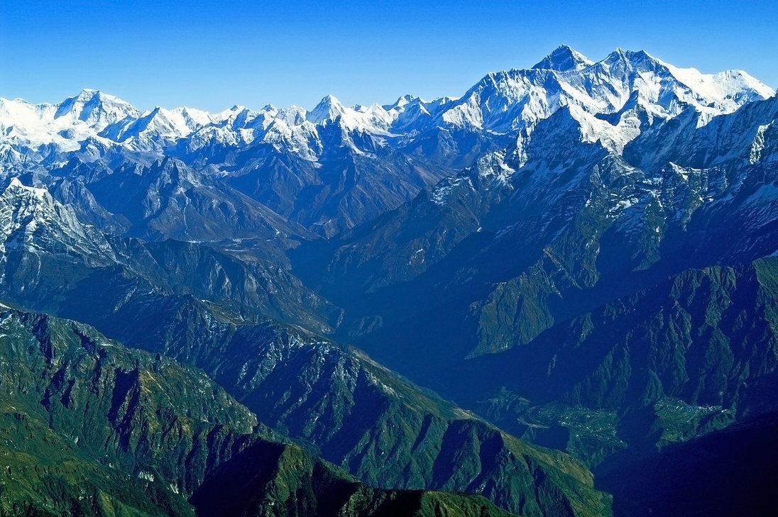
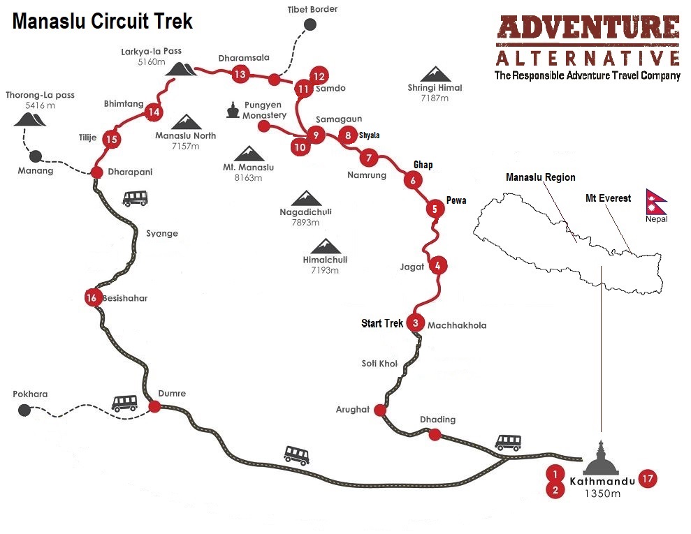
The Manaslu Circuit trek is a stunning 13-day journey (18 days including travel and days in Kathmandu) which treks around the world’s eighth highest mountain, beginning in the busy market town of Soti Khola, going up and back along a different path, ending in Syange.
Overview
This is a trek for someone who wants something different in Nepal but still offers the most striking and jaw-dropping scenery.
Many people liken the Manaslu Circuit trek to the Annapurna before it got busy! It is in a region which was closed to outsiders until the early 90’s and tourism is still restricted. It is also not quite as high as the Annapurna circuit and really is a stunning and less trodden path.
What Our Adventurers Think:

On behalf of Derek and I, we just wanted to drop you a short note to say an incredible thank you for our trip to Nepal. It is slightly surreal being back in the office this morning after seeing some of the stunning scenery in Nepal, not to mention the effort involved in procuring said scenery !! We also would just like to say a special note of thanks both to Jangbu and the porter he arranged, Bikas. Jangbu’s combination of being not just a fantastic guide but also a thoroughly decent/likeable bloke added massively to the overall experience (not sure he fully understood my Glaswegian accent at all times mind you). Bikas ability to never stop smiling lugging 25kg up and down hills will also live long in the memory. Overall we could not have been happier with the pair of them. If we recommend to friends or return again ourselves you will certainly be our first port of call. Thanks and regards, Ricky


In Touch with the Himalayas
Here is a short clip from independent traveller Tatiana Kolgunova that perfectly captures the essence and beauty of the Manaslu region.
In touch with the Himalayas. Around Manaslu in Nepal, 2016. from Tatiana Kolgunova on Vimeo.
Manaslu Circuit Itinerary
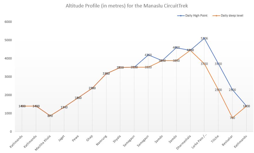
The drive from Kathmandu to Machikhola takes around 8 hours and the return drive from Besisahar to Kathmandu takes around 7 hours. The trek ascent is for 9 days, which includes two full days rest / acclimatisation which stay at the same overnight village, to the last settlement. After one day climbing up and over the high point of Larkya La at 5160m with excellent panoramic views of Himlung Himal, Cheo Himal, Kang Guru and Annapurna II, the descent is then another 3 days.
Arrival in Kathmandu, transfer to your hotel or our guesthouse.
Rest day and possibility of a sightseeing tour if you would like to see around Kathmandu. Trek briefing.
We will leave Kathmandu in the early morning for a 7 / 8 hr drive to Machha Khola where the Manaslu region treks begin. It is around 160 kilometres from Nepal’s capital to this small village location. If you’re traveling by private vehicle from Kathmandu to Machha Khola, it takes roughly 6 to 8 hours. Taking a public transportation vehicle to Machha Khola takes approximately eight to ten hours. Machha Khola is located approximately 870 meters (2,854 feet) above sea level.
The road to Machha Khola is in reasonable condition but it can, depending on local conditions have occasional off-road sections. Previously, Arughat was the starting point for the Manaslu Trek or Tsum Valley Trek, however recent road construction has made it possible to travel to further to Machha Khola.
This morning we ease into our trek by leaving Machha Khola and soon reach Khorlabesi, where there is a small natural hot spring. After an uphill section we’ll then cross the Budi Gandaki via a suspension bridge. Today’s trail takes us through forests, along ridges with great views and undulates until we reach our destination and home for the night at the village of Jagat
The trek from Jagat to Pewa is a scenic and moderately challenging section of the Manaslu Circuit Trek. This stretch takes you through beautiful landscapes, suspension bridges, rivers, and traditional villages. The trail from Jagat to Pewa is well-marked, mix of stone-paved paths, forest trails, and suspension bridges. We start from the beautiful stone built village of Jagat (1,340m) and trek uphill towards Salleri and Sirdibas, passing small settlements with terraced fields, with beautiful views of the Budhi Gandaki River below.
After hiking from Sirdibas we can see the large Gurung village with chortens and prayer flags at Philim (1,570m). It is also the same route to the Tsum Valley junction. After Philim, the trail descends and climbs again through forests and passes Ekle Bhatti, a small rest stop with basic lodges. The trail then becomes narrow but still has scenic views across to the waterfalls. After crossing a long suspension bridge over the Budhi Gandaki River we enter a dense rhododendron and bamboo forests. We venture through the forest finally reaching Pewa, which is a quaint, peaceful village with a few teahouses and an ideal place to stay overnight.
This section of the Manaslu Circuit Trek takes you through dense forests, stunning waterfalls, and traditional Tibetan-influenced villages. The altitude gradually increases, and the scenery becomes more dramatic. From Pewa to Ghap the trek begins with a scenic walk through bamboo and rhododendron forests. We need to Cross two suspension bridges over the Budhi Gandaki River before arriving at Deng, a small village with a few teahouses. From Deng the views of Siringi Himal (7,161m) are spectacular.
After a short ascent to Rana village, the trail continues along forested ridges with occasional steep sections. We then pass through the small settlement of Bihi Phedi with beautiful Mani walls and Prayer Wheels. The trail then follows an undulating path along the river and next to more lush forests. After crossing multiple wooden and metal suspension bridges we finally reach our destination of Ghap, which is a charming traditional village with Mani Walls and Chortens.
Today is a shorter day with this section of the Manaslu Circuit Trek taking us through dense forests, traditional Buddhist villages, and increasing altitudes with stunning views of the surrounding Himalayas. The trek is a gradual but a steady ascent, offering a mix of scenic beauty and cultural experiences.
From Ghap to Prok (2,580m), the trail follows a dense pine and rhododendron forest, with occasional steep sections. We agina cross multiple suspension bridges over the Budhi Gandaki River. There is an option for a side trek to Prok village, which offers amazing views of Siringi Himal (7,161m).
From Prok to Namrung (3,180m), the trail gradually ascends through forests filled with mossy trees and waterfalls. We pass many Mani Walls, Chortens, and Prayer flags, signalling a strong Tibetan Buddhist influence in this region. The last section involves a steep climb on stone steps before reaching Namrung.
Namrung is a well-developed village with a Tibetan culture, traditional houses and monasteries. The village also has a number of tea houses, bakeries, and good accommodation options. From here we have stunning views of Ganesh Himal, Himal Chuli, and Siringi Himal.
This is one of the most scenic sections of the Manaslu Circuit Trek, offering breathtaking views of snow-capped peaks as you enter the high Himalayan region. The trail takes you through traditional Tibetan villages, monasteries, and expansive alpine landscapes.
From Namrung to Lihi (2,900m), we begin with a gentle climb past Mani walls and Chortens until we will reach Lihi, a small Tibetan-style village with barley fields and monasteries. From this point we will should have clear views of Manaslu, Himal Chuli and Ganesh Himal.
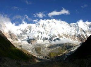
From Lihi to Lho (3,180m), the trail descends slightly before climbing up through pine forests. We arrive at Lho, a beautiful village with a large Ribung Monastery and stunning views of Manaslu (8,163m). This is a great place for a tea break and monastery visit.
From Lho to Shyala (3,520m),the trail ascends gradually, passing through dense forests and yak pastures. We arrive in Shyala, a wide-open valley surrounded by towering peaks with more incredible views of Manaslu, Himal Chuli, Ngadi Chuli, and Peak 29. The 360-degree mountain views make it a perfect place to rest overnight before heading to Samagaun.
This is a short day but an incredibly scenic section of the Manaslu Circuit Trek, bringing you closer to Mount Manaslu (8,163m). The trail passes through open valleys, yak pastures, and traditional Tibetan settlements, offering breathtaking Himalayan views.
From Shyala to Samagaun (3,530m), we initially start with a gentle descent through a wide-open glacial valley, again crossing wooden bridges over small streams formed by melting glaciers. As we walk through yak pastures with incredible views of Manaslu, Himal Chuli, and Ngadi Chuli again passing numerous traditional Chortens, Mani Walls, and small Prayer Wheels that mark the entrance to Samagaun.
Samagaun is one of the biggest villages on the Manaslu Circuit, heavily influenced by Tibetan culture. Houses in Samagaun are built in traditional stone architecture and locals wear Tibetan-style clothing. We will have amazing views of Manaslu (8,163m) towering directly above the village.
At these higher altitudes it is necessary to rest and spend a bit of time at the same height, or walk and bit higher and return to our overnight height to aid our acclimatisation, and before attempting climbs to higher altitudes. You can rest or there are options for some activity, such as exploring the Gompa at Pugyen (4070m), a one day hike that leaves the trail between Syaula and Sama. If time permits, it is possible for you to carry on up this valley to the rugged rocks and terrain of the Pugin glacier. Another option is a trip to the lake at Birendra Tal (3450m) or a demanding ascent to Manaslu Base Camp (4900m). It is believed that north of Birendra Tal is Milarepa’s Cave (famous Buddha) claimed to have been used as a meditation retreat by the Buddhist saint.
This section of the Manaslu Circuit Trek is a short but but also another step towards good acclimatisation for our journey ahead we we ascend further into the high-altitude region. The landscape becomes more barren and rugged, with fewer trees and more open valleys as we approach the remote Tibetan-influenced village of Samdo.
From Samagaun to the Budhi Gandaki River (3,700m), the trail follows a gentle climb out of Samagaun. We then cross the Birendra Lake junction with the Manaslu Glacier to our left. We then continue along a wide valley with small yak pastures and scattered chortens and cross the Budhi Gandaki River via a wooden bridge.
From Budhi Gandaki to Samdo (3,890m) the trail ascends gradually along a barren, rocky landscape. If we are lucky enough we may see blue sheep and Himalayan Marmots along the way. We will soon see Samdo come into view, which is a remote village just 4 km from the Tibetan border and our destination for the day.
Samdo (3,890m) is at high altitude, so spending an extra day for acclimatisation is crucial before heading toward Dharamsala (Larke Phedi) and Larke Pass (5,106m). This rest day helps prevent altitude sickness and prepares your body for the higher elevations ahead. We can go on some local walks or relax such as:
Hike to the Tibet Border Viewpoint (~5,000m) – 5/6hrs – this is the old trade route to Tibet, used by locals for centuries. It offers breath taking views of the Tibetan plateau, Samdo Glacier, and Mount Manaslu. There is a high chance of spotting blue sheep, Himalayan eagles, and even snow leopards.
Hike to Samdo Ridge (~4,500m) – 3hrs – Amazing panoramic views of Manaslu (8,163m), Samdo Peak, and Dharamsala. This is a less strenuous option than the Tibet Border hike but still beneficial for acclimatisation. Great photography spot for sunrise or sunset.
Or, stay local and explore Samdo Village & Monastery – experience Tibetan culture, visit a small monastery and interact with locals. Watch the traditional yak herding and admire the Tibetan-style stone houses.
Today we again gain altitude as we prepare for the crossing of the Larke Pass (5,106m) the next day. The trail becomes more barren and rugged, with stunning views of snow-covered peaks and glaciers.
From Samdo to Larke River Crossing (4,200m), the trail starts with a gentle climb through rocky meadows and yak pastures. We again cross small wooden bridges over the Larke River which reflect magificent views of Manaslu and Samdo Peak. The surrounding glaciers are even more spectacular as we climb.
From Larke River to Dharamshala (4,460m) the trail gradually ascends over glacial moraines and rocky slopes. All being well we’ll continue to spot blue sheep and Himalayan marmots along the barren landscape. We soon arrive at Dharamsala (Larke Phedi) which is a small seasonal settlement with basic but comfortable accommodation.
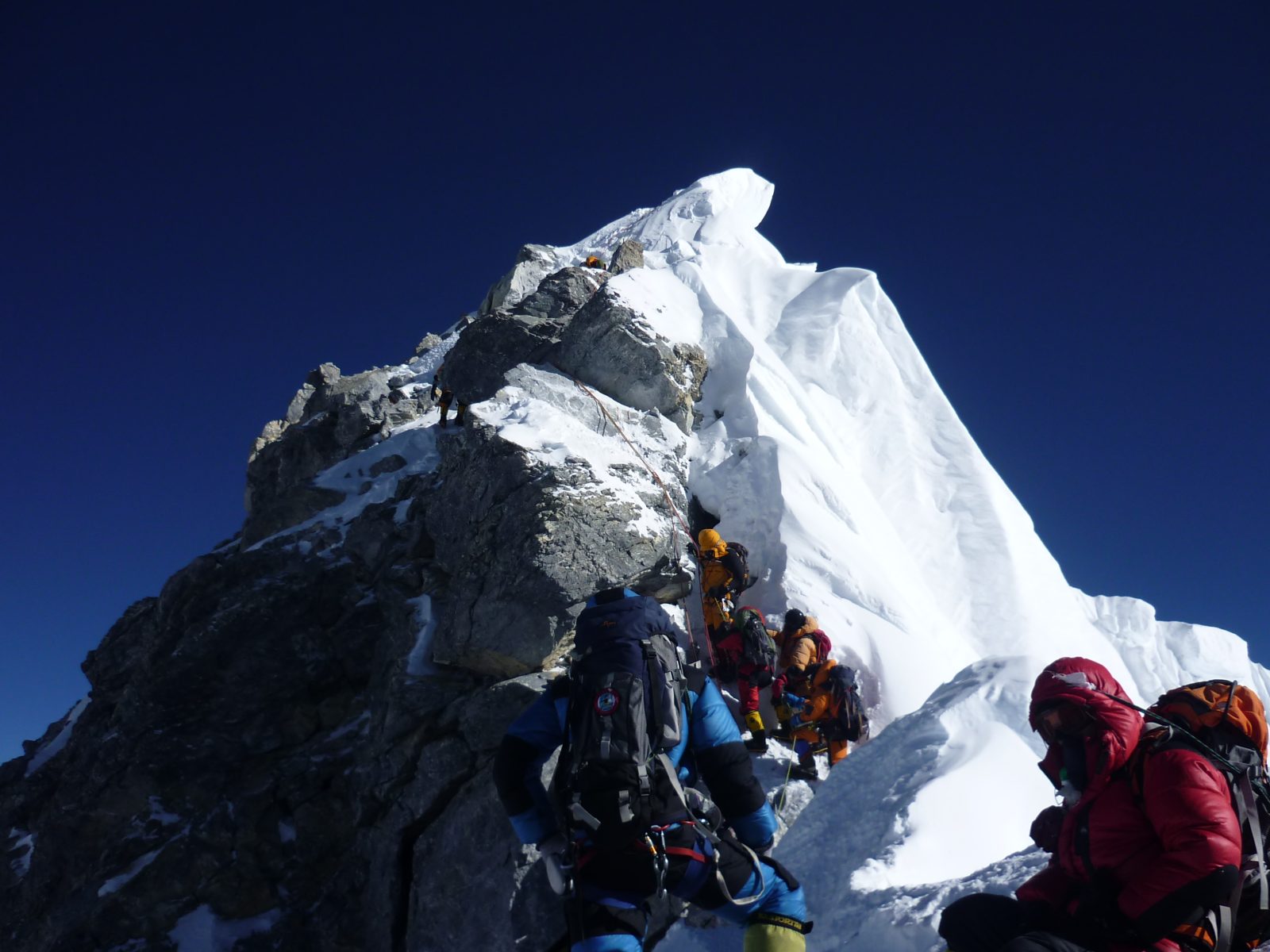
This is the most challenging and rewarding day of the Manaslu Circuit Trek! We have prepared well in terms or our acclimatisation as today we cross the Larke La Pass (5,106m), the highest point of our trek. The climb is demanding but the panoramic views of Himalayan giants make it an unforgettable experience. After reaching the pass you descend into the beautiful alpine valley of Bimthang (3,720m).
From Dharamsala to Larke Pass (5,106m) takes about 3-5 hours. We will start early in the morning (around 3-4 am) to cross the pass before the afternoon winds arrive. The climb is gradual but long with rocky and glacial moraines under foot. As you ascend the view of the Larke Glacier and surrounding peaks is stunning. The final section to the pass is steep and challenging and often covered in snow. After reaching Larke Pass (5,106m) we are treated to incredible views of Manaslu (8,163m), Himlung Himal (7,126m), Kang Guru (6,981m), and Annapurna II (7,937m). Prayer flags and Chortens mark the highest point of the trek.
From Larke Pass to Bimthang (3,720m) is a further 4-5 hours. The descent is long and steep, requiring careful footing on loose scree and occasionally icy patches. We pass through a rugged glacial valley with huge icefalls and rocky moraines. As we descend the landscape transitions from barren high-altitude terrain to lush alpine meadows before finally entering Bimthang (3,720m), which is located in a stunning valley surrounded by snow-capped peaks.
Today we continue our descent and in addition to the valley and trees below, we also have fantastic views of Manaslu, Lamjung Himal, Himlung Himal, and Cheo Himal throughout the day. Our trail takes us through the the town of Karche (2785m), which is the highest farming point in the area, and crosses the Dudh Khola river. We also pass through rhododendron trees before reaching Gho Village for a quick respite. We then continue to Tiliche (2300m) for the night.
The trail today follows a rocky path along the Dudh Khola river past Mani stones until we reach Thonje Village. We pass through a police checkpoint and then head to Dharapani at which point we connect with the main Annapurna trail. From Dharapani we will take a Jeep to Besisahar a journey of about 4 hours. Our last night of trek is then spent at Besisahar and right out of altitude at 760M.
Today we drive back to Kathmandu. It’s a scenic drive and strange, after the mountains to be amongst daily life again. After 6/7 hours we will reach Kathmandu and will drop you off at your hotel.
If our itinerary runs as planned this can be your departure or onward travel day. However, trekking in these regions can be impacted by inclement weather conditions or internal travel delays. Therefore we recommend allowing yourself an extra day to facilitate any delays, and if it’s not needed, you can relax and enjoy the bustling and vibrant sights of Kathmandu on a city tour.
Ready for an Adventure of a Lifetime?
Choose a scheduled date or contact us to set up private dates or a bespoke itinerary. The minimum deposit is £200.00 and the balance is due six weeks before travel.
Fixed Itineraries
| Start Date | End Date | Days | Price (per person) | |
|---|---|---|---|---|
| 11/04/2026 | 28/04/2026 | 18 | £1,795.00 | Book Now |
| 02/05/2026 | 19/05/2026 | 18 | £1,795.00 | Book Now |
| 03/10/2026 | 20/10/2026 | 18 | £1,795.00 | Book Now |
| 31/10/2026 | 17/11/2026 | 18 | £1,795.00 | Book Now |
Private Itineraries
Our Manaslu Circuit Trek Experts
Pasang Tendi Sherpa is one of the company directors in Nepal and a mountain leader. He has been working with Adventure Alternative since 2005 and has made three climbs of Mount Everest with Gavin.
He lives in New York with his wife Sarasoti and their two children Jubilee and Elli Dolma, and he travels to Nepal during the trekking seasons and helps manage the company and run some treks and climbs.
He has had plenty of experience managing expedition and...
Manaslu Circuit Trek: £1,795.00
INCLUDES
- Airport transfers
- Land transport to / back from Kathmandu to the trek start / finish points – public. Private is available, please ask for a quote
- Accommodation in lodges/tea houses (twin rooms with beds and mattresses)
- All meals on trek, with a hot drink
- National Park Fees & Permit
- Sherpa guides (English speaking, trained in first aid)
- Porters
- Staff food, insurance and equipment
EXCLUDES
- International flight to Kathmandu (~700 -900)
- Accommodation in Kathmandu (~ £15 – £25pp/n) – we can book this for you. Click here for details
- Meals and drinks in Kathmandu (~£50-100)
- Personal costs on trek, e.g cold drinks, laundry, hot showers, bottled water (~£70)
- Travel Insurance (~£100) must cover trekking at altitude & helicopter rescue in the event of an evacuation
- Visa (~$30)
- Tips (~£50)
- Sightseeing Tours
Payments
A deposit of £200 is required on booking to secure your place and we ask that the remaining balance (trip price minus the deposit) is paid in full 6 weeks prior to your departure. You can also pay by instalments.
Manaslu Circuit Trek Length and Terrain
Terrain on the trek is on a well trodden path all the way, though this can be rocky and uneven in parts. It is not precipitous and there is no rock climbing or ‘mountaineering’ which requires equipment. It is a walk all the way, although some of the hills can be steep and never-ending! The Manaslu Circuit trek is 180km in length, roughly 110 miles. Each day varies in length; a fit walker should expect several days of walking for 6 to 7 hours and some challenging days within the itinerary. More detail is under the ‘Itinerary’ tab.
You will meet people along the way, and also yaks. There is only one rule of the road when meeting an oncoming yak, and that is to always ensure you step to one side, towards the inside of the trail, to avoid the cliff edge on the other side! Poles are useful, depending on whether you have problems with knees and if you have a personal preference for using them. Higher up, the open slopes and moraine may give you added reassurance with a pole, but again the path is quite easy to follow.
The highest point of the trek to Larkya La Pass (5135m) climbs steeply, and at times the pass can be slippery so care must be taken. But the path is well used and the ascent is not overly difficult. The approach begins after Samdo village, crossing the high pass is a strenuous day and the exposure to altitude makes the walking harder and the likelihood of altitude sickness higher, hence we have rest and acclimatisation days prior to this and we walk very slowly. This day would be a great objective for a fit hill walker with little mountaineering experience. The top of Larkya La provides astounding panoramic views of Manaslu, Cheo Himal, Himal Chuli and Himlung Himal. The terrain is never dangerous or precipitous, it is still just a walk, but requiring the usual care and caution. There is no climbing or special equipment required on the Manaslu Circuit trek but it is obviously important to have good equipment and adequately prepared for multi-day walking.
Generally, it is hot during the day (up to 20ºC) and cool in the evening (average 5ºC) with little wind and occasional rain showers in the afternoon. After Lho village, the trail enters the Nupri Region inhabited by Tibetan immigrants, where you will find yourself becoming close to culture, religions and local people.
Manaslu Circuit Trek Altitude Profile
Accommodation on the Manaslu Circuit Trek
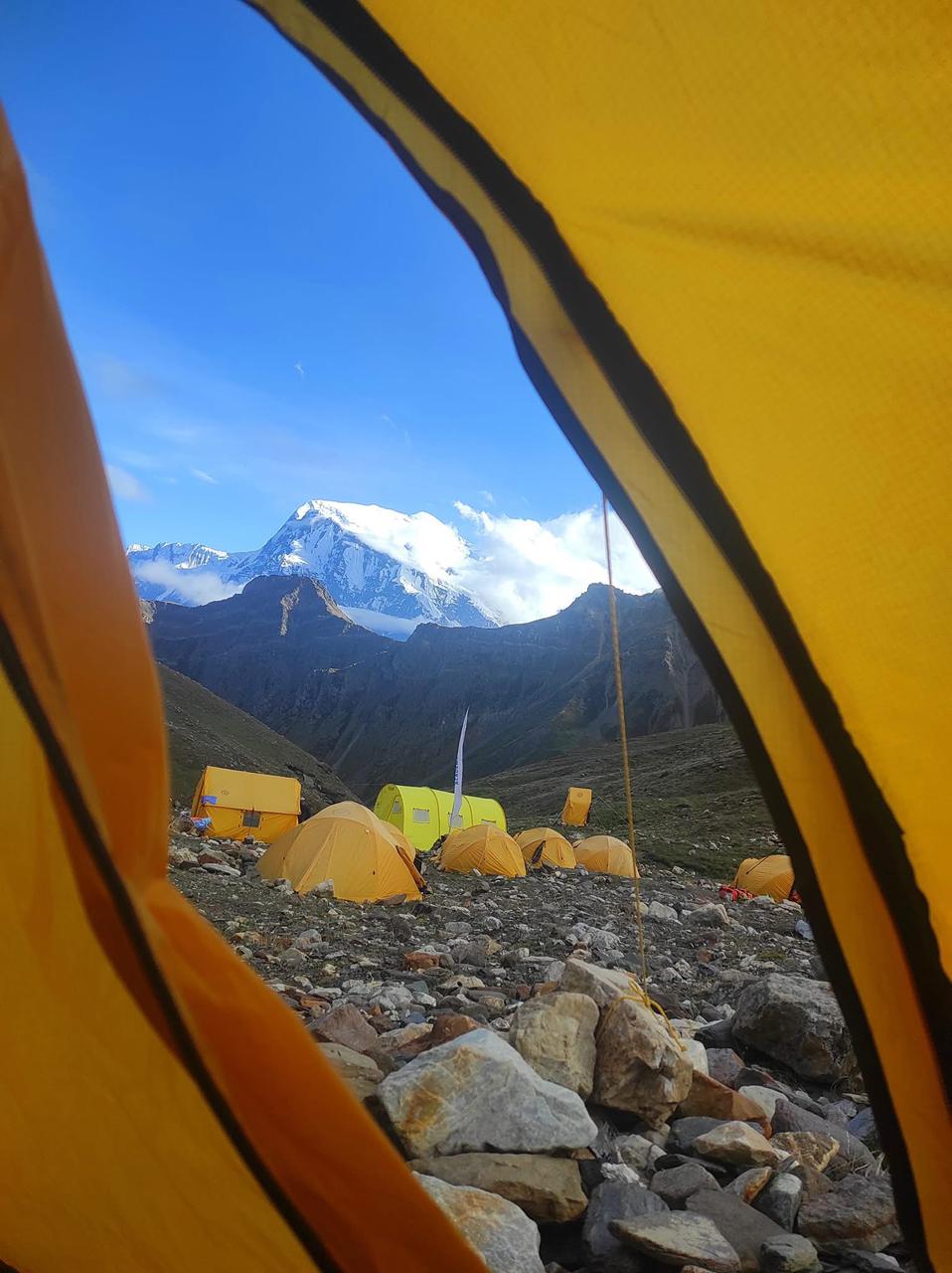
Accommodation on the trek will be in lodges and tea houses run by local families, unless people specify a preference for tents. Each lodge has a central communal area with stove, while the bedrooms are unheated with two beds and mattresses and pillows. You will need to bring a sleeping bag (3 season is normally enough), and the lodge will lend you a blanket if needed. The lodges generally have showers which are powered by gas and they use the infamous ‘drop’ toilets, though some lodges do now use a flush system.
The Manaslu region is not as populated or connected as the busier Khumbu or Annapurna regions and this is a lot of it’s attraction, but this remoteness does mean that access to phones and the outside world is less likely or can be days apart. You won’t get the pizza or burger options found in other regions but it’s authentic and tasty food, warm welcome and stunning scenery is the attraction!
Packing List for Manaslu Circuit Trek
Check out our gear recommendations and also our Nepal Trekking Kit List page for information about what gear and clothing we recommend for the Manaslu Circuit trek.
The basic idea of the clothing you will take is to keep you warm, dry, protected from the sun, able to move comfortably in the mountains and able to be comfortable in the evenings and night.
Kathmandu has an area called Thamel which is full of hundreds of equipment shops, each one an emporium of new, used, quality and fake equipment all very reasonably priced for rental and buying. You can buy almost anything needed for any trek.
The basic idea of the kit that you need is to keep you warm, dry, protected from the sun / rain / cold so that you are able to move efficiently on the mountains and able to be comfortable in the evenings and night. Consider the basics:
- BAGS – Large Duffle bag/Rucksack ~80L (for a porter to carry) + Medium Daypack ~40L (carried by you)
- SHELL – Top and bottoms to keep off wind/rain
- INSULATION – Warm layered system to keep you warm- body hands & Head
- BASELAYER – Thin layers to wick away sweat and to strip down to when it gets hot
- FEET – Comfortable, Waterproof boots to support your ankles over rough terrain. Lighter footwear to change into in the evenings.
- SLEEPING – Warm sleeping bag & Bedroll to get a good nights sleep at the lodges & camps
- EATING/DRINKING – Water bottles & favorite snacks for during the day
- WASHING & MEDICAL – To allow you to wash and maybe stave off a headache or blister
If you have any questions about what kit to bring then to please call or email us. Do consider this is a long trek though it is possible to wash items enroute drying them can at times be difficult.
Frequently Asked Questions
Key Information & Guides
General Nepal Information
Health and Safety Guides
Preparation & Kit Guides
Book Your Adventure of a Lifetime Now
Discover our trips to other Countries
Other Trips You May Enjoy
Chulu East Peak
| 21 | |
| 6584 m | |
| Difficult |
Trip Price £3,725.00
Mount Everest
| 50 | |
| 8848 m | |
| High |
Trip Price $75,000.00
Everest Base Camp Trek
| 17 | |
| 5545 m | |
| 90 km | |
| Moderate |
Trip Price £1695.00 includes trek meals
Our Nepal Posts
We’re dedicated to helping you make the most of your next adventure trekking holiday. That’s why we’ve created our travel blog full of in-depth trekking guides, travel inspiration and other fantastic information. Having done all of these climbs many times already, we want to pass on our wealth of trekking wisdom to you.
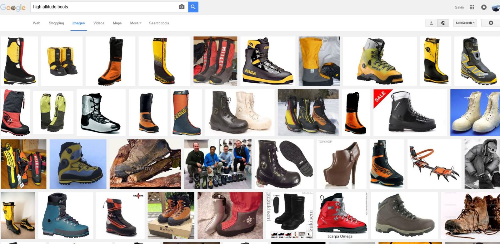
Choosing High Altitude Boots
Twenty years ago things seemed a bit simpler, climbers chose from a narrow range of leather trekking boots and generally a pair of 'double mountain'...
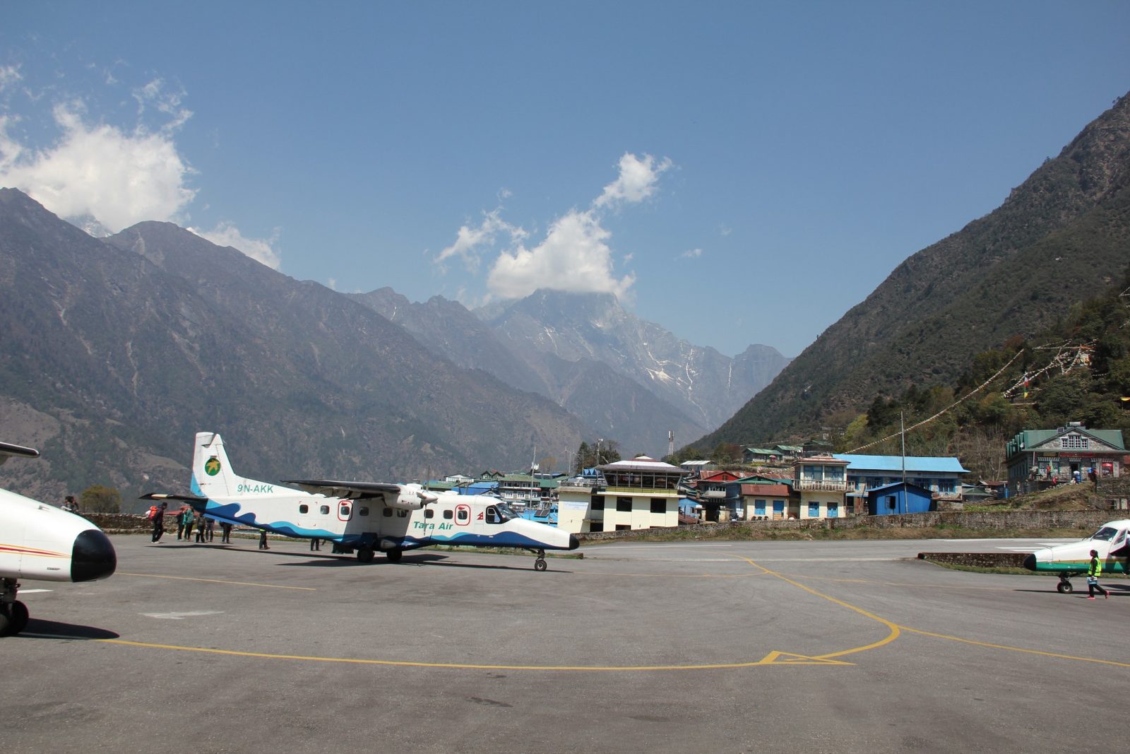
The Road to Everest
It used to be that the quickest way to get to Everest Base Camp was to fly into Lukla airport. Now all that is about to change with the building of...
Trekking With Children in Nepal
There are no rules or laws that restrict children trekking in Nepal and it is the perfect place to combine stunning scenery with an incredible...
How Hard is it to Trek to Everest Base camp?
A trek to Everest base camp is a very realistic opportunity for most people who enjoy the outdoors and have a good level of fitness and...
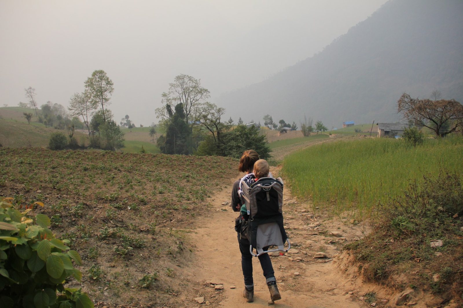
Trekking With Young Children in Nepal
I remember a friend saying he was looking forward to when his children were six or seven years old so that they could go travelling as a family to...
Accommodation in Kathmandu Guest House
We welcome trekkers, climbers, volunteers, medical students and travellers to the Adventure Alternative guest house in Kathmandu where you can get...